Foula
The Foula Story
Tales of a Shetland Island
When I travel, I like to have a purpose in mind and I chose Foula (pronounced Foo Laa) for its remoteness with the promise of good ecology and bird watching
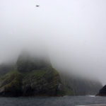
Foula Island lies out in the Atlantic – 14 miles west of the mainland of Shetland. It is three and a half miles long by two and a half miles wide, and is dominated by a ridge of four peaks from South to North, which rise to a height of 1,373 feet and end in a dramatic cliff called the Kame on the North East edge, plummeting over 1,000 feet. It is the highest sheer seacliff in the UK. These peaks, like other places on Foula,, still have their norse Names: Hamnafield, Kame, Sneug, Soberlie and the Noup (like something out of the Hobbit!). Norse was spoken on the island until the early 18th century. Due to the height of these peaks and the fact that the neighbouring islands of Shetland and Orkney are virtually flat, Foula is frequently covered in mist and has its own dramatic weather system, worth a writing a book about! And it is this weather system and the mist which makes travelling to this island totally weather dependent, whether it be by air from Tingwell or by boat, a two hour ferry trip from Walls on mainland Shetland (which is how we had to travel)
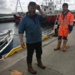
Magnus the Skipper and Rob Gear
The small island ferry is skillfully manned by the crew of Skipper, Magnus Holbourn and Lynn Robertson, crofter, with Rob Gear, trainee Skipper and Geoff– all islanders and therefore experienced sailors which you must be to sail these waters. I have sadly long since lost my sea legs and needed to fix my attention on the horizon and its wall of murky mist. Only in the last five minutes as we turned sharply into the tiny harbour of Ham Voe did I become aware of land, and what a land! My first impression was of its magnitude as it rose out of the mist. I felt about as small as a barnacle against the side of a whale


